The Fault Line · Series Finale
Israel, Its Neighbors, and the Pattern That Outlasts Empires
Section I
A Signature, a Dollar, and Thirty-Eight Centuries
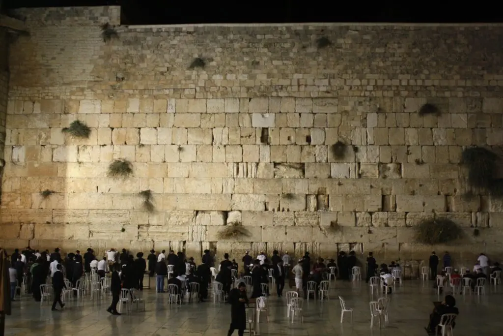
On Wednesday, at Israel’s Foreign Ministry, an American ambassador handed a symbolic one-dollar bill to an Israeli foreign minister and received, in exchange, a ninety-nine-year lease on a parcel of land in southern Jerusalem — the site where the United States intends to build its permanent embassy compound.
The land is known as the Allenby Compound, named for the British general who once ran an army base there during the Mandate years. It had another name before that. Israeli rights group Adalah, objecting on behalf of the original owners’ descendants, some of whom now hold American and Jordanian citizenship, says the plot was confiscated from Palestinian landholders under a 1950 law passed to formalize what the war three years earlier had already made irreversible.
Ambassador Mike Huckabee did not frame the signing as a real estate transaction. “I would say God made that decision 3,800 years ago,” he told the room, “and we finally got around to acknowledging what had been determined long before the United States of America came along.” A few miles away, a different anniversary was being marked in a different register: the Maccabiah Games opened in Jerusalem the same week, five thousand athletes gathered under a banner of return and resilience, in a city where the ordinary business of drawing lines around a piece of land had once again required a signing ceremony, a lease term, and a dollar.
This series has spent its length tracing a single, recurring shape across three thousand years of the land between the river and the sea — the shape of a boundary, proposed by someone with the power to propose it, and contested by someone who was not in the room when it was drawn. Having previously examined how a fifty-year-old intelligence failure repeated itself, structurally, on a single morning in October, and what a watchman’s post looks like the morning after it fails, this final installment turns from the morning of the sword to the older and quieter question underneath it: who gets to draw the line, and what happens to the line once it is drawn.
Section II
The Year Two Empires Ran Out of Time at Once
In 1947, the British Empire closed two ledgers it no longer had the will or the resources to keep open, and it closed them the same way: by drawing a line and leaving before the ink had fully dried.
In India, Cyril Radcliffe, a barrister who had never before set foot in the subcontinent, was given five weeks to draw a boundary dividing British India into two nations along religious lines. He worked from maps and census data, largely isolated from the communities his line would separate, and the boundary was not published until two days after independence had already been declared — so that no one, including the new governments meant to enforce it, knew with certainty which side of the new border their own village stood on until the migration had already begun. What followed remains, by even the most conservative estimates, one of the largest forced migrations in recorded history: something between ten and fifteen million people uprooted, and a death toll historians still cannot agree on, with figures ranging from roughly two hundred thousand to as high as two million. The uncertainty is not a footnote to the tragedy. It is a measure of how completely the speed of the withdrawal outran anyone’s capacity to account for what it cost.
The point is not Britain’s failure alone. It is the recurring temptation of every empire to believe that political lines can settle questions that history itself has not finished asking.
Six months later, the same exhausted empire handed a second unresolved territory to the newly formed United Nations. On November 29, 1947, the UN General Assembly adopted Resolution 181, a partition plan dividing British Mandatory Palestine into a Jewish state, an Arab state, and an internationally administered Jerusalem — a plan drawn largely at a conference table in New York and Geneva, by delegates most of whom had likewise never lived on the land whose future they were dividing on a map.
A line drawn by someone standing outside the territory carries a particular kind of authority — the authority of a party who will not personally live inside the consequences. Jewish leadership on the ground accepted the plan, while Arab leadership rejected it; Arab leaders argued that the proposed boundaries allocated the majority of the land’s resources and coastline to a Jewish population that, at the time, owned a small fraction of the territory outright, and regarded the plan’s terms as fundamentally unjust rather than merely unwelcome. Within six months, war had erased the plan’s boundaries entirely, and the lines that actually came to define the new state of Israel were not the ones the United Nations had drawn, but the ones an army had walked to and then stopped at.
Section III
Three Texts on Dividing What Cannot Be Cleanly Divided
The first text is older than the nation it concerns. When Abram and his nephew Lot found their combined herds and households too large for the land to sustain them both, Abram proposed a division rather than a fight among kin:
“Let there be no strife between you and me, and between your herdsmen and my herdsmen, for we are kinsmen. Is not the whole land before you? Separate yourself from me. If you take the left hand, then I will go to the right, or if you take the right hand, then I will go to the left.” (Genesis 13:8–9, ESV)
This is partition in its gentlest possible form — a division proposed by the party with the stronger claim, offered voluntarily, to preserve a relationship rather than settle a dispute by force. It is worth noticing how rare that shape of division has proven to be in every partition this series has examined since.
The second text is the most famous act of judicial division in the Hebrew Bible, and it turns on the opposite instinct. Two women brought a single living child before Solomon, each claiming to be its mother. Solomon’s test was not a boundary commission or a survey. It was a sword:
“Divide the living child in two, and give half to the one and half to the other.” (1 Kings 3:25, ESV)
The true mother, the text says, was revealed not by her claim but by her horror at the proposed division — she would rather surrender the whole child than see it split in half. The false claimant was willing to accept the division rather than lose entirely. Solomon’s wisdom did not lie in drawing a better line. It lay in recognizing that some realities are destroyed by the very act of dividing them.
The third text is a boundary law, plain and unadorned, repeated twice in the Torah and once in Proverbs: “You shall not move your neighbor’s landmark, which the men of old have set” (Deuteronomy 19:14, ESV). The instruction assumes a world in which boundary stones, once placed, are meant to hold — and it assumes that the temptation to move them quietly, a little at a time, in one’s own favor, is common enough to require its own commandment.
Section IV
The Line, Redrawn
Since Balfour, nearly every generation has produced its own version of Radcliffe’s dilemma — a line drawn under pressure, by people who would not personally live inside it, that then failed to hold in practice.
The Balfour Declaration of November 1917 is the line’s first modern instance: a single sentence from the British government, addressed to Lord Rothschild, favoring the establishment of a national home for the Jewish people in Palestine, while adding — in the same sentence — that nothing should be done to prejudice the civil and religious rights of the non-Jewish communities already living there. Historians across the political spectrum have long noted the tension built into that one sentence: a promise of national home extended to one people, layered over a promise of protected rights extended to another people occupying the same land, with no mechanism specified for reconciling the two if they proved incompatible. They proved incompatible.
The 1947 partition line, as already traced, dissolved within six months into the boundaries of war rather than the boundaries of a resolution. Those boundaries produced, on the Israeli account, a war of independence secured against five invading Arab armies; on the Palestinian account, a nakba — catastrophe — in which somewhere between seven hundred thousand and seven hundred fifty thousand Palestinians fled or were expelled from homes that became, for most of them, permanently inaccessible. These are not merely competing slogans. They are competing historical narratives supported by overlapping bodies of evidence, even where historians continue to dispute causes, responsibility, and interpretation. In the same years, a comparable number moved in something closer to the opposite direction: historians estimate that between eight hundred thousand and one million Jews left or were expelled from Arab and Muslim-majority countries between 1948 and the 1970s, a displacement whose scale is broadly comparable to the Palestinian exodus and whose political meaning remains, even among historians who accept both sets of facts, a matter of ongoing and largely unresolved argument.
The line that could not hold as a map has held, instead, as an inheritance — passed down as a grievance on one side of the fence and a foundation story on the other. The 1949 armistice lines, informally called the Green Line, became the de facto boundary until 1967, when a third war redrew them again. The Oslo Accords of the 1990s produced a further internal partition — Areas A, B, and C, each with its own layered jurisdiction — that was designed as a temporary five-year framework and instead calcified into the permanent geography of the West Bank, the same deferral this series traced in the installment before last. Gaza was partitioned yet again in 2005, when Israel withdrew its settlements and military presence unilaterally, and once more in 2007, when Hamas took control of the territory by force from the rival Palestinian Authority.
The most recent chapter, still being written as of this summer, is not a new line so much as the same line’s latest renegotiation. The ceasefire reached in October 2025, after two years of war following the October 7 attack, holds in general outline while remaining unsettled in its particulars — a truce, not a resolution, occupying the same unfinished category as every partition line that preceded it. And the Allenby Compound, ninety-nine years and one dollar, is that same pattern compressed to the scale of a single building lot: land whose legal status changed by decree in 1950, now hosting a diplomatic headquarters justified, this week, not by the decree of 1950 but by a claim dated thirty-eight centuries earlier. Solomon’s test asked which party would rather lose the whole case than see the disputed thing divided. Every line this section has traced was drawn, instead, by parties willing to accept a divided outcome — which is precisely why none of them, so far, has held.
Section V
The Ground Remembers What the Paperwork Forgets
A boundary stone, in the old law, was not a suggestion. It was a marker meant to outlast the argument that placed it, precisely because everyone involved understood how easily a stone could be moved a few feet in the dark, a little at a time, until an entire field had quietly changed hands. The law against moving it did not assume good actors. It assumed the opposite, and legislated accordingly.
This week’s signing was not framed, by the ambassador who signed it, as the drawing of a new line. It was framed as the acknowledgment of a line that already existed, older than any government now claiming jurisdiction over it. Whether or not a reader accepts that theological framing, the practical history traced across this series suggests something more modest and considerably harder to dismiss: every party to this land, across every century this series has covered, has believed something similar about its own claim — that the claim precedes the paperwork, and that the paperwork is merely catching up to a truth older than itself. Balfour’s government believed it. The delegates who wrote Resolution 181 believed it, on both sides of the vote. The families still holding the deeds Adalah cited this week believe it too.
Solomon did not settle his case with a boundary commission, a resolution, or a lease. He settled it by finding the one party in the room who could not bear to see the thing divided at all — and it is worth sitting, without rushing to a conclusion, in how few of this land’s boundary lines, from Radcliffe’s pen to this week’s compound, have ever been drawn by a party willing to lose the whole rather than accept the half.
Paper can record a settlement. It cannot create one. A line may end a negotiation, but it cannot by itself end a history. The ground remembers longer than governments do.
Footnotes
1. On the July 1, 2026 land-allocation signing, the Allenby Compound’s history, and Adalah’s objection: “Israel, US sign land agreement for permanent American embassy complex in Jerusalem,” The Times of Israel, July 2026; “US signs agreement to build permanent embassy in Jerusalem,” Free Malaysia Today (AFP), July 2026.
2. On the Radcliffe boundary process and displacement figures: “How the Partition of India happened — and why its effects are still felt today,” The Conversation, 2025; Imperial War Museums, “Partition of India: Why India was divided in 1947.”
3. On the disputed death toll of Partition: Harvard Gazette, “Harvard scholars take fresh look at the Partition of British India,” 2023 (estimates ranging from roughly 200,000 to 2 million, with no scholarly consensus).
4. On the text and structure of the Balfour Declaration (November 2, 1917): UK National Archives, Balfour Declaration facsimile and correspondence records.
5. On 1948 Palestinian displacement and Jewish displacement from Arab and Muslim-majority countries: historical consensus on comparative displacement scholarship (Benny Morris; Martin Gilbert; UN General Assembly and UNRWA archival records; Encyclopaedia Britannica; Oxford Reference); U.S. Congressional resolutions H.Res. 185, S.Res. 85, H.R. 6242 calling for parallel recognition of both refugee populations.
6. On the October 2025 ceasefire and its current status: PBS News and UN OCHA humanitarian updates, as cited in the previous installment of this series.